Antelope Canyon and Horseshoe Bend Tours
Guided slot canyon access, flood warnings and the overlook trail near Page
Guided access and the landscape
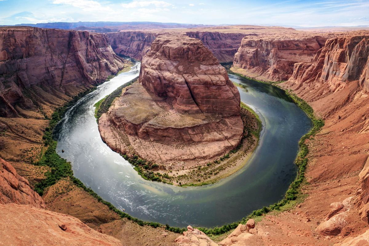
Antelope Canyon is a slot canyon on Navajo land east of Lechee, Arizona. Visits are by guided tour only, and summer rains can flood the canyon quickly. Combined tours commonly stop at the Horseshoe Bend overlook. Page, near Horseshoe Bend, has an arid climate with hot, very dry summers, classed as BWk in the Köppen system. The sandstone at Horseshoe Bend is notable for its crossbedding and iron concretions.
Upper and Lower Antelope Canyon
Antelope Canyon has six separate slot canyon sections on the Navajo Reservation, including Upper and Lower Antelope Canyon. Lower Antelope Canyon is a harder hike than Upper Antelope Canyon, even with the stairways installed. The lower canyon has five flights of stairs of varying widths to help visitors go down and climb out. Below Lower Antelope Canyon, kayakers can paddle about 1 to 2 miles into the canyon, depending on water levels (as of 2024).
- 6Separate slot canyon sections
- 5Flights of stairs in Lower Antelope Canyon
- 1.5Round-trip hike to the Horseshoe Bend overlook (miles)
- 5Distance of the trailhead south of Page (miles)
Flash floods and closures
Eleven tourists died in a flash flood in Lower Antelope Canyon on August 12, 1997. Storms upstream feed the basin, and flash floods can reach the canyon even when little rain falls at the site.
- A NOAA Weather Radio and an alarm horn are kept at the fee booth for flood warnings.
- Flash flooding still occurs in Antelope Canyon near Page and can close it for up to several months.
The Horseshoe Bend overlook and photography rules
The hike to the Horseshoe Bend overlook is 1.5 miles round-trip on a hardened path. The parking lot and trailhead are about 5 miles south of Page on US Highway 89. The City of Page charges for parking at the trailhead, and National Park passes do not apply.
Photography in the canyons is difficult: light reflecting off the walls creates a wide exposure range, often 10 EV or more. Flying drones is prohibited in Glen Canyon National Recreation Area unless the superintendent approves it in writing.
More tours around Page
A guided tour of Glen Canyon Dam exists, descending through the dam to the generator room. The route from Page to the Grand Canyon South Rim's Desert View East Entrance runs on Highway 89 south to Cameron, then Highway 64 west.
Tours near Horseshoe Bend
Frequently asked questions
Can Antelope Canyon be visited without a guide?
No. Antelope Canyon can only be visited on a guided tour, and summer rains can flood it quickly.
Which part of Antelope Canyon is the harder hike?
Lower Antelope Canyon is a harder hike than Upper Antelope Canyon, even with the stairways installed. It has five flights of stairs of varying widths for going down and climbing out.
How long is the walk to the Horseshoe Bend overlook?
The hike is 1.5 miles round-trip on a hardened path.
Where is the Horseshoe Bend trailhead and does parking cost anything?
The parking lot and trailhead are about 5 miles south of Page on US Highway 89. The City of Page charges for parking, and National Park passes do not apply.
Does flooding ever close Antelope Canyon?
Yes. Flash flooding still occurs in Antelope Canyon near Page and can close it for up to several months.
Are drones allowed in Glen Canyon National Recreation Area?
Flying drones is prohibited unless the superintendent approves it in writing.
More tours near you
Sources
- Antelope Canyon
- Page
- Horseshoe Bend - Glen Canyon National Recreation Area (U.S. National Park Service)
- Page, Arizona
- Horseshoe Bend (Arizona)
- Directions - Glen Canyon National Recreation Area (U.S. National Park Service)
- How Do I Travel to the South Rim ? - Grand Canyon National Park (U.S. National Park Service)